High-quality ground data — the foundation of every reliable model
In-Situ & Field Measurements
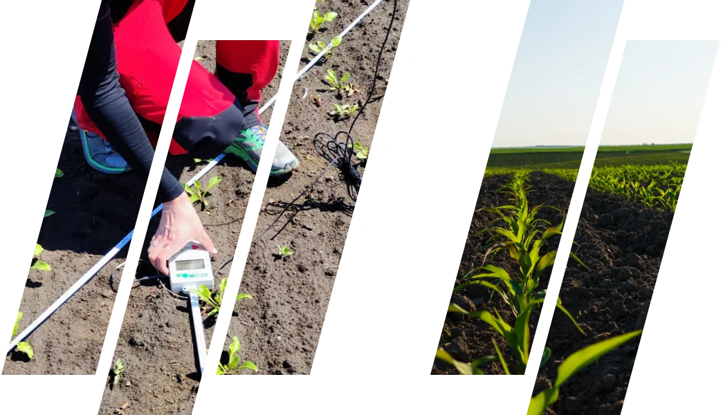
Tens of thousands of field measurements, collected across multiple countries and locations since 2020. This is the ground truth that calibrates and validates everything we model.
The accuracy of any model or satellite-based analysis starts with the quality of its input data. We build that quality at the source — in the field.
Since 2020, our teams have carried out measurement campaigns across multiple countries and locations, accumulating tens of thousands of in-situ measurements. The result is a deep, consistent field record spanning soil and a wide range of crops — sugar beet, potato, tomato, barley, wheat, and grasslands — collected season after season under controlled, repeatable protocols.
Long-term experience matters here. Field conditions vary; instruments drift; light changes by the hour. What turns a single day of readings into a usable dataset is method — and method is what five years of continuous campaigns have given us.
Our Equipment
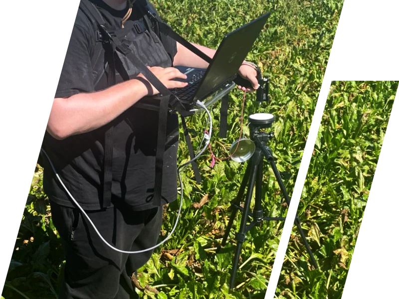
The accuracy of a dataset starts with the instruments behind it. We operate field-grade spectrometric equipment and certified calibration references, used to harmonized protocols so measurements stay comparable across sites, seasons, and missions.
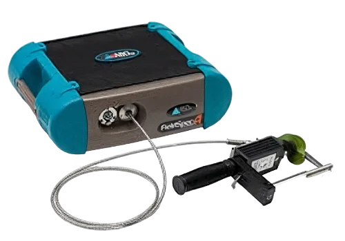
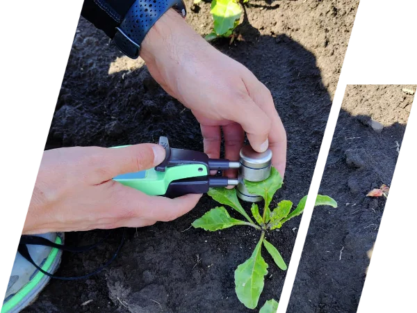
ASD FieldSpec 4 Hi-Res spectrometer
High-resolution reflectance across the full optical range (350–2500 nm), capturing the spectral detail required for both soil and vegetation analysis.
Calibration standards
Field and laboratory calibration using reference panels, ensuring radiometric consistency between campaigns and traceability back to a known reference.
Accredited laboratories
Soil and vegetation samples undergo comprehensive chemical and biophysical analysis in accredited facilities, anchoring spectral data to measured ground properties.
Mission-harmonized protocols
Our field methods are aligned with current and upcoming hyperspectral satellite missions — Sentinel-2, EnMAP (DLR), PRISMA (ASI), and the Copernicus CHIME mission.
How We Plan and Run a Campaign
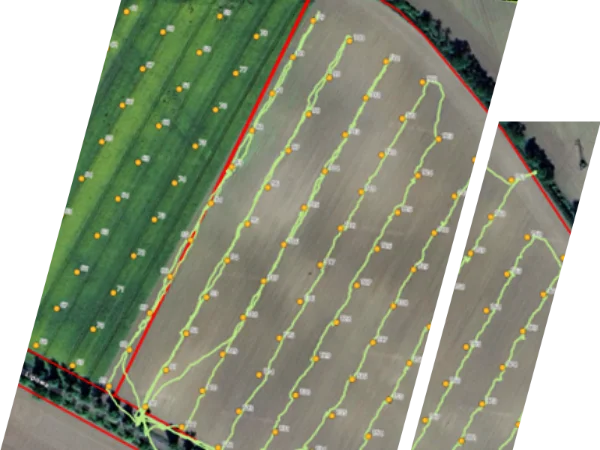
A field campaign is only as good as its design. Before anyone enters the field, we define what is being measured and why — the target parameters, the sampling density, and the acquisition window aligned to satellite overpasses.
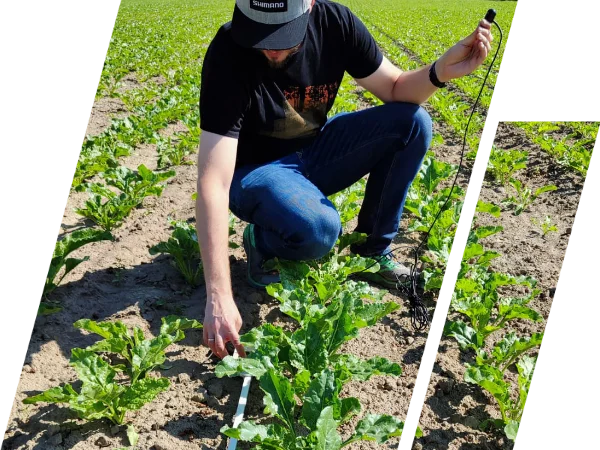
In the field, calibration is continuous, not a one-off step. White-reference and dark-current measurements are repeated throughout the day to compensate for changing illumination, and each spectral reading is co-located with its corresponding soil or biomass sample.
The samples then move to accredited laboratories for chemical and biophysical analysis. Field readings, laboratory results, and satellite acquisitions are integrated through a workflow built around traceability — so every value in the final dataset can be linked back to where, when, and how it was measured.
Spectral measurements of soil and vegetation using high-resolution spectrometers (ASD FieldSpec 4 Hi-Res)
Sampling and laboratory analyses supporting the characterization of physical, chemical, and biological properties
Coordination with satellite overpasses (Sentinel-2, EnMAP, PRISMA, CHIME) for dataset harmonization
Data integration workflows ensuring traceability between field, lab, and satellite observations
This is the difference between data that is merely collected and data that can calibrate and validate a model.
Plan your own field campaign with us
Tell us what you need to measure, and we will design the campaign around it — from sampling design to a delivered, traceable dataset.
Need to measure something else? Our methods extend well beyond standard soil and crop parameters — contact us to discuss your case.
Manage Consent
To provide the best experiences, we use technologies like cookies to store and/or access device information. Consenting to these technologies will allow us to process data such as browsing behavior or unique IDs on this site. Not consenting or withdrawing consent, may adversely affect certain features and functions.
Functional Always active
The technical storage or access is strictly necessary for the legitimate purpose of enabling the use of a specific service explicitly requested by the subscriber or user, or for the sole purpose of carrying out the transmission of a communication over an electronic communications network.
Preferences
The technical storage or access is necessary for the legitimate purpose of storing preferences that are not requested by the subscriber or user.
Statistics
The technical storage or access that is used exclusively for statistical purposes.The technical storage or access that is used exclusively for anonymous statistical purposes. Without a subpoena, voluntary compliance on the part of your Internet Service Provider, or additional records from a third party, information stored or retrieved for this purpose alone cannot usually be used to identify you.
Marketing
The technical storage or access is required to create user profiles to send advertising, or to track the user on a website or across several websites for similar marketing purposes.